UN adopts new map projection that corrects Africa's size
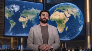
The United Nations has updated its standard map projection to more accurately represent the true size of Africa, which has been distorted for centuries. The change aims to correct the misconception that Africa is smaller than it actually is. The new projection is expected to be used in official UN materials.
The United Nations has formally revised its cartographic standard, addressing a long-standing visual inaccuracy in global maps. This update specifically targets the historical misrepresentation of Africa's landmass, which has been systematically minimized in conventional projections.
By adopting this new projection, the UN aims to dismantle the widespread false impression regarding the continent's relative scale. The revised standard will now be integrated into all official UN documents and publications, ensuring future representations reflect the true geographic proportions.
This cartographic shift could gradually reshape public perception of global geography, particularly among educators and students who rely on UN materials. By presenting Africa's true scale, it may influence how international audiences understand economic and demographic comparisons. Policymakers and NGOs might also reassess visual data in reports, though the practical impact on real-world decisions remains indirect and dependent on broader adoption.