Iowa's 11,000 Factory Farms Reveal Key Insights in New Mapping
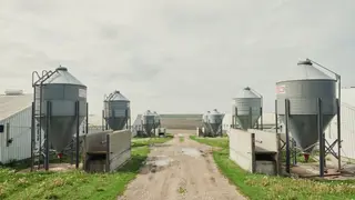
A comprehensive mapping of Iowa's factory farms uncovers five significant findings about the state's concentrated animal feeding operations. The data highlight the scale and distribution of industrial agriculture in the region. These insights aim to inform public awareness and policy discussions.
The new spatial analysis highlights the sheer density of concentrated animal feeding operations across Iowa, numbering over eleven thousand. This detailed cartography reveals how these industrial facilities are distributed, offering a clearer picture of their geographic footprint. The scale underscores the dominance of intensive livestock production in the state's agricultural landscape.
By visualizing this infrastructure, the data provides a foundation for understanding the regional concentration of animal agriculture. The findings are intended to serve as a reference point for both public awareness and ongoing policy deliberations. Such mapping efforts often help stakeholders grasp the physical extent of industrial farming, which is a central feature of modern food supply systems.
The mapping could significantly influence public discourse on industrial agriculture in Iowa. Residents living near these facilities may gain a clearer understanding of their proximity to large-scale operations, potentially shaping local concerns about air and water quality. Policymakers could use this data to evaluate zoning, permitting, or environmental regulations. The findings may also affect consumer awareness regarding food sourcing, though the immediate impact likely centers on community advocacy and regulatory review.