Iceland Braces for Severe Storm and Orange Travel Alerts
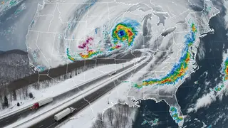
Iceland's meteorological office has issued orange weather alerts for the Westfjords and parts of the northwest ahead of a strong low-pressure system expected on October 14. Forecasts indicate gale-to-storm-force winds, heavy rain or snow, and poor visibility that could make travel impossible in some areas. Yellow alerts cover much of the rest of the country, with the worst conditions expected in the west and northwest during Wednesday afternoon and evening.
Iceland’s weather service has placed the Westfjords, Strandir and Northwest Iceland under orange warnings, while yellow alerts stretch across much of the country, including the south, southeast, Faxaflói and Breiðafjörður. The deep low is forecast to cross on Wednesday, October 14, with early easterly or northeasterly gales, rain at lower levels, and mountain sleet or snow.
Later, winds are expected to turn northerly in the northwest, bringing colder snowstorm conditions. Peak impacts are projected for Wednesday afternoon and evening, when sustained winds may reach 18–25 meters per second, roads could accumulate snow, and some routes may become impassable. Southern and southeastern yellow warnings begin at 06:00.
The storm could disrupt daily life for residents and travelers in western and northwestern Iceland, especially those using the Ring Road, mountain passes, airports or ferries. With orange and yellow alerts in place, people may face dangerous crosswinds, poor visibility, surface water and snow-covered or impassable routes. Transport operators might need to adjust services, while visitors could see itineraries delayed or cancelled. Those in affected areas may need to monitor official updates and plan around possible no-travel conditions during the peak.