Satellite Data Reveal Two Magma Reservoirs Under Nicaragua’s Masaya Volcano
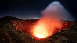
Using six years of satellite observations, researchers detected two separate magma reservoirs beneath Nicaragua’s Masaya volcano. Ground around one deeper source first sank and then rose, while the area near Santiago crater and its lava lake continued to subside, suggesting different magma movements. The discovery could aid eruption forecasting for a volcano located close to roughly 2 million people.
Masaya sits near Managua and is made up of several overlapping craters and large collapse basins called calderas. Although its last major lava flow occurred in 1772, it continuously releases sulfur dioxide, which can reach hazardous levels for visitors and nearby residents.
Over six years, satellite measurements showed the ground near a deeper magma source first dropping and later rising, while the zone around Santiago crater and its lava lake kept sinking. This pattern points to two distinct underground magma bodies behaving independently, according to Penn State researchers writing in Geophysical Research Letters.
The finding may sharpen monitoring of Masaya, potentially giving scientists earlier clues about changing hazards. That could benefit the roughly 2 million people living nearby, as well as tourists visiting the caldera national park, by supporting better warnings and safety decisions. It may also inform how officials interpret sulfur dioxide degassing and ground movement, though the research does not by itself predict an eruption.