Hatteras Island Visitors Told to Leave Ahead of Nor’easter Flood Risk
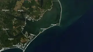
Dare County declared an emergency and told all visitors to leave Hatteras Island starting at 8 p.m. EDT on October 16. Forecasters issued a coastal flood warning through October 20, warning of 2–4 feet of inundation and 8–14 foot breaking surf in exposed areas. Officials expect repeated overwash and prolonged flooding that could close N.C. Highway 12 and cut off road access.
Dare County’s emergency declaration preceded a mandatory visitor departure from Hatteras Island at 8 p.m. EDT Oct. 16. The evacuation applied to seven villages but not residents or areas north of Oregon Inlet. Forecasters later raised the coastal flood watch to a warning, predicting 2–4 feet of inundation and 8–14-foot surf through Oct. 20.
Transportation crews reinforced dunes and drainage on Pea, Hatteras and Ocracoke islands, staged equipment, and readied emergency ferry terminals. A late-September nor’easter had damaged roughly 1,000 feet of N.C. Highway 12 on Pea Island, prompting the first Rodanthe–Stumpy Point emergency ferry activation since 2013; a temporary one-lane gravel road reopened the route Sept. 29.
Visitors and residents on Hatteras Island may face disrupted travel, lost access to jobs, supplies, and emergency services if N.C. Highway 12 closes. Businesses dependent on tourism could see cancellations and revenue losses during an already storm-prone period. Ferry crews and road teams may be strained by repeated overwash. Prolonged flooding could also isolate communities, complicate medical access, and delay recovery, though preparations may reduce some risks.